04
Your outings have a memory.
Find passages, statistics and tracks. Replay a moment and place each event back on the chart.
Connected sailing, in every dimension
Plan the route. Live the passage. Learn from every mile. From weather routing to the Performance workshop, your whole boat comes together in one place.
Invitation-only beta · Try the demo without an account
Discover what changes aboardWeather, routing, polars and boat preparation.
Live chart, instruments, AIS and a link to shore.
Replay, analysis, coaching and progress.
Your new navigation station
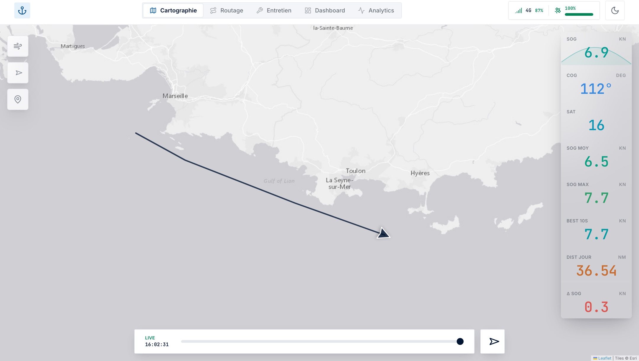
A chart to navigate, weather to anticipate, data to improve. Explore the NavLiveConnect views.
Position, track, weather and instruments work together. Aboard or ashore, stay connected to the passage.
From data to mastery
A complete workshop to understand what your boat can do, what slows you down and how you improve.
Compare measured speed to your reference polar, upwind and downwind.
See speed loss, recovery time and estimated cost in metres.
Edit polars, review observations and build your sailchart.
Find trends across sessions and advice grounded in your data.
More than a dot on a chart
Outings, crew, family, maintenance and spending all have a place in the same space.
Find passages, statistics and tracks. Replay a moment and place each event back on the chart.
Set the course, invite crews and follow boats, rankings and marks. Share the race with your club.
Share a public link with no account needed. Chat and add text, photos, video or audio to the track.
Pick your indicators, explore curves and records, then export raw data for further analysis.
Organise tickets, priorities and due dates. Keep work records and invoices from one season to the next.
Compare actual spending to the yearly budget and track forecasts by category. Every invoice keeps its context.
From your boat to every screen
Data is collected aboard, sent to the cloud and available in your browser. Choose how to connect your boat.
GPS / NMEA
4G / Wi-Fi
Desktop & mobile
Public link & chat
Track your boat with the Tracker app. It collects your position and resumes uploads when the connection returns.
Connected to the NMEA network, it collects instruments, records aboard and synchronises over 4G. Its Wi-Fi provides a dedicated configuration interface.
Online viewing and live tracking require Internet access. Available data depends on your position source and connected instruments.
A space for the way you sail
From discovery to complete analysis, choose the modules you need.
To discover navigation and live tracking.
€0
To get startedNavigation, plus the boat maintenance log.
€20/ yr
Annual subscriptionFrom weather routing to analysing every sail.
€45/ yr
Annual subscriptionAnnual Full, connected to your NavLiveConnect 4G box.
€60/ yr
Annual subscriptionFAQ
The demo lets you explore navigation, instruments, routing and the Performance workshop with demonstration data. The platform is in beta and personal access opens gradually by invitation.
No. The Tracker app on iPhone can transmit your GPS position. The NavLiveConnect 4G box adds NMEA network data and onboard storage; purchase availability is coming soon.
It brings together session analysis, VMG, polar comparison, maneuver losses, coaching, targets, sailchart and progress. Results depend on available data; polar learning remains subject to your review and validation.
Routing uses your boat’s polar, wind, sea state, current and coastline. Compare sail-only and sail-with-engine strategies, weather models where available, and export a route as GPX.
Yes. Share a public tracking link with no account or install required. It gives access to tracking, chat and passage posts. Regattas also have a public race chart.
Your next mile starts here
Explore the product now, or join the waitlist to create your space as new invitations become available.